
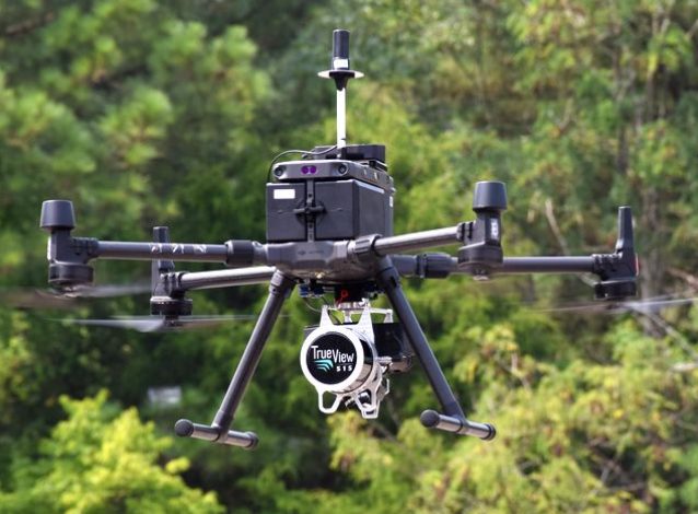
LiDAR vs Photogrammetry for Drone Surveying
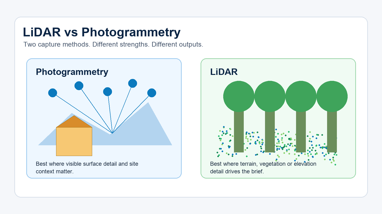
Photogrammetry and LiDAR both create spatial data, but they answer different site questions. Photogrammetry turns overlapping photos into maps and models. LiDAR measures distance with laser pulses and produces a point cloud that can support terrain and elevation work.
If the site is visually open and the client needs an orthomosaic, model, progress record or surface measurement, photogrammetry can be a practical choice. If vegetation, terrain or elevation detail drives the brief, LiDAR may be the better capture method.
HexFlix provides aerial survey services for commercial projects across Brisbane, the Gold Coast, the Sunshine Coast and Australia wide.
When Is Drone Photogrammetry the Better Choice?
Photogrammetry depends on image overlap. The drone captures multiple images from planned positions, then specialised software identifies shared points across those photographs. Depending on the project requirements, the resulting data can be used to produce an orthomosaic, 3D model, digital surface model, contours or volume calculations.
One of the main strengths of photogrammetry is its visual context. A project manager can see the site as well as its geometry. This makes photogrammetry useful for construction progress, roof mapping, stockpile context, facade documentation and site reporting.
Its main limitation is also visual. If the camera cannot see the ground, the model cannot reliably describe the ground. Long grass, tree canopy, shadows, water, reflective surfaces and areas with limited visual texture can reduce the quality or completeness of the resulting model.
Photogrammetry also depends on consistent flight planning. Poor image overlap, changing light, reflective materials or missed capture angles can create gaps in the model. For repeat progress mapping, the flight plan should be reproducible so the client can compare outputs captured at different stages of the project.
When Is Drone LiDAR the Better Choice?
LiDAR uses laser pulses to measure distance. The resulting data is generally produced as a point cloud, which can then support terrain models, elevation products or asset measurements.
LiDAR becomes valuable when the brief is focused more on the shape of the land or structure than on photographic site detail. It may capture returns through gaps in vegetation, which is why it is often considered for vegetated corridors, uneven terrain, infrastructure assets and locations where photogrammetry may only represent the top of the vegetation.
LiDAR cannot automatically overcome every site condition. Dense canopy, unsuitable flight planning, weak control and inappropriate processing can still limit the result. The sensor, capture method and processing workflow all affect the quality of the final data.
The decision should begin with the required output. If the project team needs a visual map for communication or progress reporting, photogrammetry may be sufficient. If the team needs terrain information beneath partial vegetation or detailed elevation data, LiDAR may be worth considering.
How Do LiDAR and Photogrammetry Compare?
| Survey question | Better starting point | Why it matters |
|---|---|---|
| Do we need a clear visual map of the site? | Photogrammetry | An orthomosaic provides strong photographic context. |
| Do we need ground data beneath partial vegetation? | LiDAR | Laser returns may capture terrain through gaps in vegetation. |
| Do stakeholders need clear progress evidence? | Photogrammetry | Photographs can make site changes easier to understand. |
| Is elevation detail the main requirement? | LiDAR | Point clouds can support terrain and elevation products. |
| Is budget the main constraint? | Photogrammetry | Camera based capture can often be more economical. |
| Is the site technically complex? | Scope the project first | Some projects may require both methods or specialist review. |
What Determines Drone Survey Accuracy?
Clients often ask which method is more accurate. A more useful question is what level of accuracy the project requires and how that accuracy will be checked.
Accuracy can be affected by flight height, image overlap, point density, sensor calibration, ground control, RTK or PPK workflows, lighting, wind, surface type and data processing. An advanced drone flown without a suitable plan can produce weak data. A more modest aircraft flown according to a carefully prepared plan can produce useful results for the right brief.
If legal boundaries, cadastral information or formal survey certification are involved, a licensed surveyor may be required. Drone data can support the wider workflow, but the responsibility for reviewing and certifying the information must be clearly established.
The phrase “survey grade” should also be used carefully. It may refer to data suitable for design, asset management or formal cadastral work, depending on who is using the term. These applications do not have identical requirements. The project scope should state the required tolerance, control process and review responsibility.
Why Do Ground Control Points Matter?
Ground control points connect drone data to known locations. They can help align project outputs and improve confidence in the data, particularly when the client requires measurements, repeat surveys or files that will be handed to another consultant.
Some drone workflows use RTK or PPK positioning. These tools may reduce the need for dense ground control, but they do not remove the need for quality checks. For projects where accuracy is important, independent checkpoints can help establish whether the output is suitable for its intended purpose.
Ground control can also improve comparisons between data captured on different dates. If a construction or earthworks site is mapped each month, alignment is important because the client is looking for meaningful change. Weak control may make change detection less reliable.
Which Drone Survey Outputs Should You Request?
Begin with the decision that the data needs to support. If the client needs to brief contractors or communicate project progress, a visual map may be enough. If the project requires terrain information, contours or integration with a design workflow, the required deliverables may include point clouds, GeoTIFF files, contours or CAD compatible files.
A useful drone survey scope should identify the deliverables, coordinate system, file formats, accuracy requirements, coverage area and review process. A vague request for survey grade drone mapping can cause problems because different clients and consultants may interpret that phrase differently.
The people who will use the files should be involved when preparing the brief. This helps confirm that the selected capture method, coordinate system and output format are compatible with the project’s wider workflow.
What Should Be Confirmed for a Brisbane Drone Survey?
Brisbane sites can involve controlled airspace, active construction areas, vegetation, steep terrain, reflective roofs and restricted access. These conditions can affect the selected capture method and whether the required data can be collected during a single site visit.
Before booking a drone survey, confirm the site boundary, required outputs, vegetation level, delivery format, deadline and who will rely on the information. If the output will support engineering, design or legal decisions, establish who will review or approve the data.
For commercial mapping, talk to HexFlix about aerial survey services in Brisbane or submit your project details through the HexFlix contact page.
How Can You Prepare a Better Drone Survey Brief?
Understanding the difference between a visual map, surface model, terrain model and point cloud helps buyers provide clearer project information. A better brief allows the drone operator to assess the site requirements and recommend an appropriate capture method.
The brief should include the site location, required coverage, vegetation conditions, output files, accuracy expectations, deadline and intended use of the data. If a civil consultant, engineer, asset manager or licensed surveyor will use the output, that person should help define the requirements before the flight takes place.
Universal accuracy promises should be treated cautiously. The achievable result depends on the site, equipment, control process and intended deliverables. A defined workflow and clear project scope provide more useful information than an accuracy figure presented without context.
Frequently Asked Questions
Is LiDAR better than photogrammetry?
LiDAR is often better suited to projects involving terrain and vegetation challenges. Photogrammetry is often more suitable when clear visual site context is required. The better method depends on the information the project needs to produce.
Can photogrammetry create contours?
Yes. Photogrammetry can support the creation of contours when the capture and processing methods are suitable. If vegetation hides the ground, the contours may describe the visible surface rather than the true ground level.
Can LiDAR see through trees?
LiDAR may capture some ground returns through gaps in vegetation. It does not see directly through solid vegetation, and dense canopy can still limit the amount of ground information captured.
Do drone surveys need ground control?
Many drone survey workflows benefit from ground control points or independent checkpoints. The requirements depend on the expected accuracy, site conditions, capture method and intended use of the data.
Can drone mapping replace a licensed cadastral survey?
No. Legal boundary and cadastral work must involve the appropriately licensed survey professional. Drone data may support related project work, but it does not automatically replace professional surveying or certification.

Leave a Reply
Want to join the discussion?Feel free to contribute!